Mount Rushmore

“The purpose of the memorial is to communicate the founding, expansion, preservation, and unification of the United States with colossal statues of Washington, Jefferson, Lincoln, and Theodore Roosevelt.”
— Gutzon Borglum

Rushmore1

The mountain was carved from 1927-1941, if carved is the word for dynamite. The last 3-6 inches was removed by drilling sufficient holes to crumble the granite away.

Click any of the photos for larger versions of all.

Rushmore2 Rushmore3
Rushmore4 Rushmore5

The heads are approximately 60 feet tall; the noses about 20 feet, Washington’s slightly larger.

Rushmore6
Rushmore7 Rushmore8
Rushmore9

Around 400 men and women worked on the project. The time-clock was at the top of 700 stairs.

All photos taken August 31, 2009. I’ve already written about Custer State Park and Fort Laramie, although we visited them after Mount Rushmore. This is the last of the road trip reports.

The Badlands

The bizarre landforms called badlands are, despite the uninviting name, a masterpiece of water and wind sculpture. They are near deserts of a special kind, where rain is infrequent, the bare rocks are poorly consolidated and relatively uniform in their resistance to erosion, and runoff water washes away large amounts of sediment. On average, the White River Badlands of South Dakota erode one inch per year. They are formidable redoubts of stark beauty where the delicate balance between creation and decay, that distinguishes so much geologic art, is manifested in improbable landscapes – near moonscapes – whose individual elements seem to defy gravity. Erosion is so rapid that the landforms can change perceptibly overnight as a result of a single thunderstorm.

Badlands National Park

Badlands1
Badlands2
Badlands3
Badlands4

Photos taken Sunday, August 30, 2009. Click any image for larger versions.

The Black Hills

I know you’ll be disappointed to read that I have just three more installments of road trip photos.

Deadwood

We spent the night in Deadwood, South Dakota, looking for Joanie’s place but to no avail. They discovered gold in the Black Hills in 1874, and from the rush came the town of Deadwood. They discovered modern gambling in Deadwood in 1989 and from that rush came the preservation of an interesting little town, though one that looks nothing like it did in the TV series. Still, better than most tourist communities, and some amenities including this pretty good restaurant. Several places in Deadwood take the name No. 10 because the original No. 10 was the location of Wild Bill Hickok’s death.

Homestake

Just three or four miles from Deadwood is Lead (pronounced Leed), South Dakota. That’s where the serious gold was. Fred and Moses Manuel and Hank Harney staked their claim called Homestake on April 9, 1876. George Hearst, father of William Randolph Hearst, bought the claim in 1877 for $70,000. The mine closed in 2002 after nearly 40 million ounces of gold and 9 million ounces of silver had been extracted. We tend to think of gold mining as something one does in a cold stream with a flat pan. The real ore came from big industrial mines run by big industrial mining companies.

CrazyHorse

The Crazy Horse Memorial is the world’s largest mountain carving. It is carved with explosives. The work began in 1948. When finished the front part of the mountain will be a horse’s head. The long strait line will be the Oglala Lakota warrior’s arm pointing to the distance. You can see the face. Note the vehicles in the photo at the base of the rock to get some idea of the scale.

Click any of the images for larger versions.

America’s First National Monument

President Theodore Roosevelt proclaimed Devils Tower a national monument 103 years ago today. It was the first landmark set aside under the Antiquities Act.

Devil's Tower

The nearly vertical monolith known as Devils Tower rises 1,267 feet above the meandering Belle Fourche River. Once hidden below the earth’s surface, erosion has stripped away the softer rock layers revealing Devils Tower.

Known by several northern plains tribes as Bears Lodge, it is a sacred site of worship for many American Indians. The rolling hills of this 1,347 acre park are covered with pine forests, deciduous woodlands, and prairie grasslands. Deer, prairie dogs, and other wildlife are abundant.

Source: National Park Service

NewMexiKen, who has circumnavigated Devils Tower, thinks it should be renamed Bears Lodge.

Roosevelt added several more monuments after Devils Tower, including El Morro, Montezuma Castle, Petrified Forest, and Chaco Canyon within the first year of the Act.

Where the Buffalo Roamed

There, in a patch of rolling grassland, loosely hemmed in by Bismarck, Dickinson, Pierre, and the greater Rapid City-Spearfish-Sturgis metropolitan area, we find our answer.

Between the tiny Dakotan hamlets of Meadow and Glad Valley lies the McFarthest Spot: 107 miles distant from the nearest McDonald’s, as the crow flies, and 145 miles by car!

Weather Sealed has a map of the lower 48 showing the density of Mickey Dees. More interesting than you’d think.

During our recent 6-day trip from Michigan to Denver we did not eat at a national chain restaurant even once.

Fort Laramie

We arrived at Fort Laramie, Wyoming, around 6:30 and had the place to ourselves — well there were a bunch of bunnies and one ranger who left his lair long enough to give us each a brochure. (Jill visited Fort Laramie two years ago and says that they too had it to themselves except for a ranger or two.)

FortLaramie1

It may be quiet now but Fort Laramie was once one of the crucial outposts on the frontier. It was founded as a fur-trading center in 1834 near the confluence of the Laramie and North Platte rivers. In the 1840s it became an important stop on the Oregon Trail.

FortLaramie2

As the Oregon boom and California gold rush escalated traffic on the Trail, relations with Indians became stressed. The army purchased the outpost in 1849. Fort Laramie was a stop on the short-lived Pony Express. After the Civil War, it became increasingly a military staging area in the Indian wars and a safe haven for travelers on the Deadwood-Cheyenne stagecoach route.

FortLaramie3

Fort Laramie was abandoned as a military post in 1890. It seems pretty well abandoned by everyone else today.

Click photos for larger versions.

When Travelers Leave Their Good Manners at the Gate

A good story from a good column at Frequent Flier:

I was in first class, and we were on the tarmac waiting to take off. A woman, in about row 35 starting talking on her cellphone. No problem. Except she was speaking so loudly you could hear her all the way up front. Everyone started looking at each other and we were all thinking the same thing: Please keep your voice down.

She told the person she was speaking with to call her back. And then, in a really loud voice, she gave her cellphone number to the person she was on the phone with. I committed that number to memory. And then I waited about 10 seconds and called her cell.

When she answered, I told her she was being too loud and everyone on board the plane could hear every word of her conversation. And it wasn’t that interesting.

She started screaming at me, demanding to know who I was. So I told her to look toward the front of the plane. I stood up and waved at her with a big smile on my face. She hung up, sat down and no one heard from her the rest of the flight.

Fort Caroline National Memorial (Florida)

… was authorized on this date in 1950. According to the National Park Service:

Fort Caroline

Fort Caroline National Memorial was created to memorialize the Sixteenth Century French effort to establish a permanent colony in Florida. After initial exploration in 1562, the French established “la Caroline” in June 1564. Spanish forces arrived 15 months later. Marching north from their newly established beachhead (San Agustin) the Spanish captured la Caroline in September, 1565. Nothing remains of the original Fort de la Caroline; a near full-scale rendering of the fort, together with exhibits in the visitor center, provide information on the history of the French colony, their interaction with the native Timucua, and the colonists’ brief struggle for survival.

Whoa! You mean the French and Spanish were here even before the English at Jamestown and Plymouth Rock?

America’s Best Idea

Beautiful photos. Download desktop wallpapers as part of a promotion for the upcoming Ken Burns series The National Parks: America’s Best Idea.

Filmed over the course of more than six years at some of nature’s most spectacular locales — from Acadia to Yosemite, Yellowstone to the Grand Canyon, the Everglades of Florida to the Gates of the Arctic in Alaska — THE NATIONAL PARKS: AMERICA’S BEST IDEA is nonetheless a story of people: people from every conceivable background — rich and poor; famous and unknown; soldiers and scientists; natives and newcomers; idealists, artists and entrepreneurs; people who were willing to devote themselves to saving some precious portion of the land they loved, and in doing so reminded their fellow citizens of the full meaning of democracy. It is a story full of struggle and conflict, high ideals and crass opportunism, stirring adventure and enduring inspiration – set against the most breathtaking backdrops imaginable.

Six-episode series begins on PBS September 27th.

Thanks to Mark and Ah, Wilderness! for the link.

North Dakota

Tower1

It doesn’t look like much in these photos — frankly it didn’t look like much in reality — but from 1963-1974 and from 1991 until this year this was the tallest manmade structure on earth. It’s the tower of KVLY-TV (originally KTHI-TV) of Fargo, North Dakota, located near Blanchard, North Dakota. It is 2,063 feet tall (629 meters).

Tower2

From 1974 until it collapsed in 1991, the tallest manmade structure was the Warszawa radio mast in Poland at 2,120.67 feet (646.38 meters). This year (2009) the Burj Dubai in the United Arab Emirates reached 2,684 feet (818 meters).

The KVLY tower is now just the world’s second tallest manmade structure. A few miles away is the third tallest, the slightly shorter KXJB tower, which we could see in the distance. (No other U.S structures are above 2000 feet.)

Missouri

That’s the Missouri River near Washburn, North Dakota, site of a replica of Lewis and Clark’s 1804-1805 winter camp. What other blog has brought you photos of America’s three longest rivers in the past month?

FortLincoln

Lieutenant Colonel George Armstrong Custer and his wife Libby lived in that home at Fort Abraham Lincoln (near present-day Bismarck) from 1873 until 1876. It was from here that Custer led his invasion of the Black Hills in 1874 and began his fated trip to the Little Bighorn Valley in 1876. I have a closer shot of the house, but this is about as close as I like to get to Custer.

StandingRock

Further south along North Dakota highway 1806 is the Standing Rock Reservation. Above is a photo of the tribe’s handsome administrative services building in Fort Yates.

The Standing Rock Sioux Reservation is situated in North and South Dakota. The people of Standing Rock, often called Sioux, are members of the Dakota and Lakota nations. “Dakota” and “Lakota” mean “friends” or “allies.” The people of these nations are often called “Sioux”, a term that dates back to the seventeenth century when the people were living in the Great Lakes area. The Ojibwa called the Lakota and Dakota “Nadouwesou” meaning “adders.” This term, shortened and corrupted by French traders, resulted in retention of the last syllable as “Sioux.” There are various Sioux divisions and each has important cultural, linguistic, territorial and political distinctions.

Standing Rock Sioux Tribe

There is a monument to Sitting Bull (Tatanka Iyotake) in Fort Yates. The monument marks the possible gravesite of the great leader. (There is some dispute whether his remains were removed.)

TatankaIyotake

TatankaIyotake2

Great words (click the photo for readable version).

Alas, the usually proud Standing Rock Sioux Tribe has done a poor job maintaining the site that honors its most famous leader.

All photos taken August 29th and 30th, 2009. Click any image for a gallery of larger versions.

Old Man River when he’s just a baby

Mississippi1

The Mississippi River rises from Lake Itasca in north central Minnesota, about 20 miles southwest of Bemidji. I’d been to the spot a few years ago and I wanted to go back. The first time I had the River to myself — it was April and trying to snow and no one else was around. This time I was joined by about 150 voyageurs.

Both times being there was, for me, enthralling. I’ve been to Europe, Asia, Africa and South America. I’ve been to all 50 states more than once. Yet, for some reason I can’t explain, this is one of my favorite places on the whole planet. Go figure.

Clicking any picture should take you to larger versions of all four. Photos taken August 29, 2009.

Mississippi2

The stones mark the beginning of one of the world’s great rivers; an arm of Lake Itasca is beyond. Traffic on the stones was busy the entire time we were there. Henry Rowe Schoolcraft — explorer, geographer, geologist, ethnologist, politician, one-time University of Michigan regent, and early Indian agent — identified the headwaters in 1832.

Mississippi3

This photo was taken by turning to face downstream away from Lake Itasca (and the stones). In the distance you can see the first bridge across the not-yet-quite Mighty Mississip. (It’s a split tree trunk.)

Mississippi4

Further downstream. From here the River flows northeasterly, through Bemidji, then mostly east to Grand Rapids, before it begins its trip south through the Twin Cities and on to the Gulf of Mexico.

It’s called her birthplace

FrancesEthelGumm

… but actually she was born in the hospital on June 10, 1922. This is more accurately the early childhood home of Frances Ethel Gumm in Grand Rapids, Minnesota. She lived here until the family moved to California in 1927.

The home has been relocated from its original location.

And they’d be happy to host your wedding.

Oh, after being first called Baby Gumm, Frances Ethel Gumm later took the stage name Judy Garland.

Photo taken August 29th.

The Keweenaw

Keweenaw

The Keweenaw Peninsula curves northeasterly into Lake Superior. It is anchored by Houghton and Hancock on the south and Copper Harbor near the tip (at 47º 28′, about as far north as Seattle-Tacoma International). The average annual snowfall in Copper Harbor is 250 inches (the record is 390 inches). It was mostly sunny and cool the day we were there, August 27th.

The Keweenaw Peninsula was the site of the first copper boom in America, beginning in the 1850s. The ore is 97% copper and was extracted by the Ojibwa well before the Finns and others showed up to mine the Keweenaw.

CopperHarbor1

The Copper Harbor Lighthouse, one of the oldest on the Great Lakes, as seen from across the harbor.

CopperHarbor2

Copper Harbor and the lighthouse from Brockway Mountain Drive.

That’s Lake Superior, of course. Isle Royale National Park is out there somewhere (though actually further to the west, as this photo faces mostly north).

EagleRiver1

We spent the night on the shores of Lake Superior in Eagle River. This photo was taken from the room with my iPhone. The weather turned cold and damp that evening (and it rained much of the next day).

EagleRiver2

Eagle River has a great courthouse.

The Keweenaw is special and, though out of the way, should be included in any visit to the U.P. Click any image for larger versions.

‘Root Beer’ Falls

TahLower1
TahLower2
TahLower3

The Lower Falls of the Tahquamenon River, Michigan (click any image for a gallery of larger versions).

The Upper Falls is one the largest waterfalls east of the Mississippi. It has a drop of nearly 50 feet and is more than 200 feet across. A maximum flow of more than 50,000 gallons of water per second has been recorded cascading over these falls. Four miles downstream is the Lower Falls, a series of five smaller falls cascading around an island. … The falls can be viewed from the river bank or from the island, which can be reached by rowboat rented from a park concession. The island walk affords a view of the falls in the south channel.

This is the land of Longfellow’s Hiawatha – “by the rushing Tahquamenaw” Hiawatha built his canoe. Long before the white man set eyes on the river, the abundance of fish in its waters and animals along its shores attracted the Ojibwa Indians, who camped, farmed, fished and trapped along its banks. In the late 1800’s came the lumber barons and the river carried their logs by the millions to the mills. Lumberjacks, who harvested the tall timber, were among the first permanent white settlers in the area.

Rising from springs north of McMillan, the Tahquamenon River drains the watershed of an area of more than 790 square miles. From its source, it meanders 94 miles before emptying into Whitefish Bay. The amber color of the water is caused by tannins leached from the Cedar, Spruce and Hemlock in the swamps drained by the river. The extremely soft water churned by the action of the falls causes the large amounts of foam, which has been the trademark of the Tahquamenon since the days of the voyager.

Tahquamenon Falls State Park

TahUpper1
TahUpper2

The Upper Falls of the the Tahquamenon River.

All photos taken August 26, 2009.

Whitefish Point

WhitefishPt

At the eastern end of Lake Superior is Whitefish Bay, formed by the narrowing of the big lake between Ontario and Whitefish Point, Michigan. The prevailing westerlies on the Lake blow unfettered for hundreds of miles making the water west of Whitefish Point among the most treacherous, even as they lie nearest the safe haven of the bay. And here, where the weather is severe and where all ships must pass, is the Great Lakes Shipwreck Museum.

WhitefishPt1 WhitefishPt2

The above photos (click any image for larger version of all) show diving suits, early and recent. A suit like the modern one was used to retrieve the bell from the Edmund Fitzgerald in 1995, 500 feet below the surface. The famed Fitzgerald went down 17 miles off Whitefish Point.

WhitefishPt3

WhitefishPt4

A Great Lakes freighter leaves Whitefish Bay for the larger lake. The land beyond (looking north-northeast) is Ontario, Canada.

WhitefishPt5

The big lake they call Gitche Gumee.

All photos taken August 26, 2009. Map via Google Maps.

Grand Teton National Park (Wyoming)

… was formed on this date in 1950 by combining the much smaller national park established in 1929 (which included just the Tetons and the lakes) and the Jackson Hole National Monument established in 1943. Today the park includes nearly 310,000 acres.

Teton.jpg

Located in northwestern Wyoming, Grand Teton National Park protects stunning mountain scenery and a diverse array of wildlife. The central feature of the park is the Teton Range — an active, fault-block, 40-mile-long mountain front. The range includes eight peaks over 12,000 feet (3,658 m), including the Grand Teton at 13,770 feet (4,198 m). Seven morainal lakes run along the base of the range, and more than 100 alpine lakes can be found in the backcountry.

Elk, moose, pronghorn, mule deer, and bison are commonly seen in the park. Black bears are common in forested areas, while grizzlies are occasionally observed in the northern part of the park. More than 300 species of birds can be observed, including bald eagles and peregrine falcons.

Grand Teton National Park

Point Reyes National Seashore (California)

… was established on September 13, 1962.

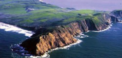
Point ReyesPoint Reyes National Seashore contains unique elements of biological and historical interest in a spectacularly scenic panorama of thunderous ocean breakers, open grasslands, bushy hillsides and forested ridges. Native land mammals number about 37 species and marine mammals augment this total by another dozen species. The biological diversity stems from a favorable location in the middle of California and the natural occurrence of many distinct habitats. Nearly 20% of the State’s flowering plant species are represented on the peninsula and over 45% of the bird species in North America have been sighted.

National Park Service

Canyonlands National Park (Utah)

… was authorized on this date 45 years ago. From the National Park Service:

Canyonlands

Canyonlands National Park preserves a colorful landscape of sedimentary sandstones eroded into countless canyons, mesas and buttes by the Colorado River and its tributaries. The Colorado and Green rivers divide the park into four districts: the Island in the Sky, the Needles, the Maze and the rivers themselves. While the districts share a primitive desert atmosphere, each retains its own character and offers different opportunities for exploration and learning.

Big Mac

The Mackinac Bridge
The Mackinac Bridge

The Mackinac Bridge is currently the third longest suspension bridge in the world. In 1998, the Akashi Kaikyo Bridge in Japan became the longest with a total suspension of 12,826 feet. The Great Belt Bridge in Halsskov-Sprogoe, Denmark, which also opened in 1998, is the second longest suspension bridge in the world with a total suspension of 8,921 feet. The Mackinac Bridge is the longest suspension bridge in the western hemisphere. The total length of the Mackinac Bridge is 26,372 feet. The length of the suspension bridge (including anchorages) is 8,614 feet. The length from cable bent pier to cable bent pier is 7,400 feet. Length of main span (between towers) is 3,800 feet.

The height of the roadway at mid-span is approximately 200 feet above water level.

Mackinac Bridge Authority

The bridge began construction in May 1954 and was opened to traffic on November 1, 1957. Mackinac, from Michilimackinac, is an Iroquois term for strait, adapted by the French and pronounced Mackinaw, which is the English spelling.

This photo was taken from the northern side, alas further from the suspension part of the bridge. Lake Michigan is in the foreground; Lake Huron beyond the bridge. Click image for a larger version.

While many states have islands, no other state is divided into two land masses like Michigan. It’s lower peninsula, shaped like a left-handed mitten, has 97% of the people and two-thirds of the land. The Upper Peninsula — more commonly the U.P. — remains one of the most rural areas in the U.S., its economy dependent on tourism and logging since its mines have closed. Many long-time residents descend from Scandinavian and Finnish miners who first settled the area.

And a favorite food is the pastie (pronounced pah-stie, not pay-stie). It’s a Cornish dish of meat, potatoes and other vegetables baked in a thick crust. A yummy lunch for miners and road-trippers.

The toll was $3. The toll taker took one look at us in the Z with the top down on a beautiful day and said, “I’d always heard that life was unfair, but this is too much.”

Sleeping Bear

Long ago, along the Wisconsin shoreline, a mother bear and her two cubs were driven into Lake Michigan by a raging forest fire. The bears swam for many hours, but eventually the cubs tired and lagged behind. Mother bear reached the shore and climbed to the top of a high bluff to watch and wait for her cubs. Too tired to continue, the cubs drowned within sight of the shore. The Great Spirit Manitou created two islands to mark the spot where the cubs disappeared and then created a solitary dune to represent the faithful mother bear.

Sleeping Bear Dunes National Lakeshore

SleepingBear1

Sleeping Bear National Lakeshore is on the Michigan shore of Lake Michigan. In the first photo (click any of the photos for an album of larger versions) you see the mother bear dune and, in the distance, South Manitou Island, one of her cubs.

SleepingBear2

This photo shows the more than 400-foot drop from the bluff to the lake (and no I didn’t make the trek).

SleepingBear3

The third photo reveals more of the top of the dune and the vegetation that fights with the ever shifting sand.

SleepingBear4

Lastly, this area of Michigan is dotted with many large lakes just inland from the Great Lake. Both Lake Michigan and the inland lakes were gouged by glaciers during the last ice age, ending some 11,800 years ago. Similarly, the glaciers amassed the hilly terrain surrounding the lakes.

Jim Harrison

Click image for larger version

I’m told that Jim Harrison did much of his writing in this cabin on his farm near Leland, Michigan, before moving to Livingston, Montana, and Patagonia, Arizona.

Jim Harrison has probed the breadth of human appetites — for food and drink, for art, for sex, for violence and, most significantly, for the great twin engines of love and death. Perhaps no American writer better appreciates those myriad drives; since the publication of his first collection of poetry, “Plain Songs,” in 1966, Harrison has become their poet laureate. His characters — and, by extension, their creator — hunger for a wild and sinewy abundance: for, in his words, “mental heat, experience, jubilance,” for a life fully lived.

The Salon Interview

Harrison’s work is considered men’s lit I suppose (or whatever the opposite of chick-lit would be called), but he was first brought to my attention by my daughter-in-law Veronica. His fiction is set mostly in rural America, often near places he’s lived.

Harrison’s latest novel is The English Major. I’ve just finished it and am eager to try another, perhaps True North or Dalva. Harrison wrote the screenplay — based on his own stories — for Legends of the Fall.

Fishtown

Click image for larger version

This is an iPhone photo taken from the table while at lunch in Leland, Michigan, August 24th. It shows just a small part of Fishtown, Leland’s authentic fishing community. (And a couple of very nice boats.)

Fishtown is a collection of weathered fishing shanties, smokehouses, overhanging docks, fish tugs and charter boats along the Leland River in Leland, Michigan. Once the heart of a commercial fishing village, the structures and docks are real places where people can walk through, see and feel a connection to Lake Michigan’s fishing heritage. For the past half-century it has been enjoyed and appreciated by thousands of visitors and regional residents who find the shanties, fish tugs and docks that make up the property a living legacy of our maritime culture. 

Fishtown Preservation Society

I had a very nice burger at lunch that day, but my aunt only let me have half so I was pretty hungry still. We had fresh whitefish bought in Fishtown the next evening. And some great green beans and slaw, all fresh and locally grown.