Category: National Parks
Descriptive information about America’s national parks, monuments and memorials, often with a photo or two.
Wild is as wild does
“Yellowstone is the only place in the lower 48 states where a population of wild bison has persisted since prehistoric times…”
Helicopters from the state of Montana at times are flying as low as 20 feet or so above ground inside the park to push herds of bison ranging in size from 200-250 animals as much as a dozen miles into the park’s interior, according to Yellowstone spokesman Al Nash.
Black Canyon of the Gunnison (Colorado)
… was authorized as a national monument on this date in 1933. It became a national park in 1999.
The Black Canyon of the Gunnison’s unique and spectacular landscape was formed slowly by the action of water and rock scouring down through hard Proterozoic crystalline rock. No other canyon in North America combines the narrow opening, sheer walls, and startling depths offered by the Black Canyon of the Gunnison.
Ignominy is thy name
Jeez, even a bull elk can screw up big time.
You think he’d been drinking?
Lincolnalia
Encouraging line of the day
“It is tight. It is cramped. It is hot. It probably isn’t completely safe to have everyone go up, in any numbers, at any time. But the Park Service is full of slightly dangerous things you can do.”
Interior Secretary Salazar after climbing to the crown of the Statue of Liberty. As senator he supported reopening the crown to the public. (I’ve been there. It is tight. It is cramped. It is hot. It is also glorious!)
White Sands National Monument (New Mexico)
… was established by President Herbert Hoover on this date in 1933.
At the northern end of the Chihuahuan Desert lies a mountain ringed valley called the Tularosa Basin. Rising from the heart of this basin is one of the world’s great natural wonders – the glistening white sands of New Mexico.
Here, great wave-like dunes of gypsum sand have engulfed 275 square miles of desert and have created the world’s largest gypsum dune field. The brilliant white dunes are ever changing: growing, cresting, then slumping, but always advancing. Slowly but relentlessly the sand, driven by strong southwest winds, covers everything in its path.
‘Earthquake swarm’ continues to rock Yellowstone
The Denver Post reported yesterday on the activity at Yellowstone:
“It’s not business as usual,” said [Utah University professor] Smith. “This is a large earthquake swarm, and we’ve recorded several hundred. We are paying careful attention. This is an important sequence.”
Smith noted that beginning in 2004, there was “accelerated uplift of the Yellowstone Caldera” that covered the entire caldera.
In 2007, Smith and his University of Utah colleagues said the current rise in the caldera was “unprecedented” but concluded that because there were no major earthquakes or “earthquake swarms” accompanying the uplift, they found “little indication that the volcano is moving toward an eruption.”
The last major earthquake swarm was in 1985 and lasted three months, Smith told The Denver Post.
The Yellowstone Plateau, which comprises Yellowstone National Park, is one of the largest super-volcanoes in the world and has gone through three volcanic cycles spanning two million years that included some of the world’s largest-known eruptions.Through 5 p.m. Dec. 31, the swarm had included 12 events of magnitude 3.0 to 3.9 and approximately 20 of 2.5 to 2.9, with a total of 400 quakes large enough to be located.
The observatory said similar swarms have occurred in the past without triggering steam explosions or volcanic activity. However, the observatory said there is some potential for explosions and that earthquakes may continue and increase in intensity.
So uplift with no earthquakes, no problem. Now we have the uplift and earthquakes, problem?
El Malpais National Monument (New Mexico)
… was established on this date in 1987.
This monument preserves 114,277 acres of which 109,260 acres are federal and 5,017 acres are private. El Malpais means “the badlands” but contrary to its name this unique area holds many surprises, many of which researchers are now unraveling. Volcanic features such as lava flows, cinder cones, pressure ridges and complex lava tube systems dominate the landscape. Closer inspection reveals unique ecosystems with complex relationships. Sandstone bluffs and mesas border the eastern side, providing access to vast wilderness.
For more than 10,000 years people have interacted with the El Malpais landscape. Historic and archeological sites provide reminders of past times. More than mere artifacts, these cultural resources are kept alive by the spiritual and physical presence of contemporary Indian groups, including the Puebloan peoples of Acoma, Laguna,and Zuni, and the Ramah Navajo. These tribes continue their ancestral uses of El Malpais including gathering herbs and medicines, paying respect, and renewing ties.
Capulin Volcano National Monument (New Mexico)
… was established in 1916 and renamed on this date in 1987.
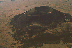
Mammoths, giant bison, and short-faced bears were witness to the first tremblings of the earth and firework-like explosions of molten rock thousands of feet into the air. Approximately 60,000 years ago, the rain of cooling cinders and four lava flows formed Capulin Volcano, a nearly perfectly-shaped cinder cone, rising more than 1000 feet above the surrounding landscape. Although long extinct, Capulin Volcano is dramatic evidence of the volcanic processes that shaped northeastern New Mexico. Today the pine forested volcano provide habitat for mule deer, wild turkey, and black bear.
What’s Driving All The Shaking At Yellowstone National Park?
It’s no secret that Yellowstone National Park is volcanic in nature. Still, scientists are raising their eyebrows over a recent swarm of earthquakes that have been shaking the park’s underpinnings.
Since December 26 the park has been hit by more than 250 earthquakes that, while not overpowering, have been in the range of a 4.0 magnitude, according to the Yellowstone Volcano Observatory.
Well, wud ya’ look at that
Richard Wetherill and his brother-in-law Charles Mason rode out on what is now Sun Point in search of lost cattle 120 years ago today and found Cliff Palace at Mesa Verde. That afternoon, Richard found Spruce Tree House, and the next day, the two men discovered Square Tower House. Al Wetherill, Richard’s brother, saw Cliff Palace sometime the year before, but he did not enter the dwelling, so the credit for “discovering” the dwelling has been given to Richard Wetherill and Charles Mason.
In 1901, Richard Wetherill homesteaded land that included Pueblo Bonito, Pueblo Del Arroyo, and Chetro Ketl in what is now Chaco Culture National Historical Park. Wetherill remained in Chaco Canyon, homesteading and operating a trading post at Pueblo Bonito until his murder in 1910. Chiishch’ilin Biy, charged with the murder, served several years in prison, but was released in 1914 due to poor health. Wetherill is buried in the small cemetery west of Pueblo Bonito.
NewMexiKen took this photo of Cliff Palace in 2006. Click image for a larger version.
National Park System Quiz
National Parks Traveler has a very difficult quiz this week about the national parks.
This week’s quiz explores many colorful aspects of our national parks. We’re going to depart from custom here and mix in some true-false and short-answer items. Answers are at the end. If we catch you peeking we’ll confiscate your crayons.
The Alaska National Interest Lands Conservation Act
… became law on this date in 1980, more than doubling the size of the national park system.

According to America’s National Park System: The Critical Documents edited by Lary M. Dilsaver:
In the waning days of the Carter Democratic administration, Congress acted to further protect and expand preserved areas in Alaska, many rescued from exploitation two years earlier by presidential proclamation. This complex and lengthy act defines preserved parks, forests, wilderness areas, wildlife refuges, wild and scenic rivers, and Native American corporation lands and the degrees of preservation and usage for each. It prescribes timber, fish, and wildlife protection and use by Native Americans and other citizens.
New areas for the national park system included Aniakchak National Preserve, Cape Krusenstern National Monument, Gates of the Arctic National Park and Preserve, Kenai Fjords National Park, Kobuk Valley National Park, Lake Clark National Park and Preserve, Noatak National Preserve, Wrangell-St. Elias National Park and Preserve, and Yukon-Charley Rivers National Preserve. The act also added new lands to Glacier Bay National Park and Preserve, Katmai National Monument and Preserve, and Denali National Park and Preserve (renamed from Mount McKinley National Park).
New wild and scenic rivers under Park Service administration included Alagnak, Alatna, Aniakchak, Charley, Chilikadrotna, John, Kobuk, Mulchatna, Noatak, North Fork of the Koyukuk, Salmon, Tinayguk, and Tlikakila rivers. Other wild and scenic rivers are designated or expanded in wildlife refuges and in other areas.
The vast majority of acreage in the Denali, Gates of the Arctic, Glacier Bay, Katmai, Kobuk Valley, Lake Clark, Noatak, and Wrangell-St. Elias units is designated wilderness.
Photo taken by Ken, official oldest son of NewMexiKen, 1998.
Conservation President
Thirty years ago today President Jimmy Carter took abrupt and sweeping action to preserve 17 endangered areas in Alaska. Carter used the 1906 Antiquities Act to prevent exploitation while the Congress deliberated. Carter’s proclamation established:
Admiralty Island National Monument
Aniakchak National Monument
Becharof National Monument
Bering Land Bridge National Monument
Cape Krusenstern National Monument
Denali National Monument
Gates of the Arctic National Monument
Enlarging the Glacier Bay National Monument
Enlarging the Katmai National Monument
Kenai Fjords National Monument
Kobuk Valley National Monument
Lake Clark National Monument
Misty Fiords National Monument
Noatak National Monument
Wrangell-St. Elias National Monument
Yukon-Charley National Monument
Yukon Flats National Monument
Two years and a day later the Congress passed the Alaska National Interest Lands Conservation Act.
Great Sand Dunes National Park and Preserve (Colorado)
… was redisignated on this date in 2000, pending land acquisition. It had been a national monument since 1932. The land was acquired and Great Sand Dunes became America’s 57th national park in 2004.
In this high mountain valley are the tallest dunes in North America, flanked by some of the highest peaks in the Rocky Mountains. The park and preserve protects much of the Great Sand Dunes’ natural system, including alpine tundra and lakes, forests, streams, dunes, grasslands, and wetlands.
And National Parks Traveler tells us that Great Sand Dunes is one of the quietest places in the U.S.
Zion National Park (Utah)
… was established on this date in 1919.

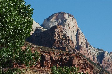
Zion is an ancient Hebrew word meaning a place of refuge or sanctuary. Protected within the park’s 229 square miles is a dramatic landscape of sculptured canyons and soaring cliffs. Zion is located at the junction of the Colorado Plateau, Great Basin and Mojave Desert provinces. This unique geography and the variety of life zones within the park make Zion significant as a place of unusual plant and animal diversity.
NewMexiKen photo, 2005
Gila Cliff Dwellings National Monument (New Mexico)
… was proclaimed a national monument 101 years ago today by President Theodore Roosevelt.
Gila Cliff Dwellings National Monument offers a glimpse of the homes and lives of the people of the Mogollon culture who lived in the Gila Wilderness from the 1280s through the early 1300s. The surroundings probably look today very much like they did when the cliff dwellings were inhabited.
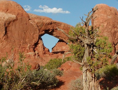
Arches National Park (Utah)
… was redesignated from national monument to national park on this date in 1971.

For there is a cloud on my horizon. A small dark cloud no bigger than my hand. Its name is Progress.
The ease and relative freedom of this lovely job at Arches follow from the comparative absence of the motorized tourists, who stay away by the millions. And they stay away because of the unpaved entrance road, the unflushable toilets in the campgrounds, and the fact that most of them have never even heard of Arches National Monument.
…The Master Plan has been fulfilled. Where once a few adventurous people came on weekends to camp for a night or two and enjoy a taste of the primitive and remote, you will now find serpentine streams of baroque automobiles pouring in and out, all through the spring and summer, in numbers that would have seemed fantastic when I worked there: from 3,000 to 30,000 to 300,000 per year, the “visitation,” as they call it, mounts ever upward [769,672 visitors in 2003].
…Progress has come at last to Arches, after a million years of neglect. Industrial Tourism has arrived.
— Edward Abbey, Desert Solitaire (1968)
NewMexiKen photo, 2003
San Antonio Missions National Historic Park (Texas)
… was established on this date in 1978.
Four Spanish frontier missions, part of a colonization system that stretched across the Spanish Southwest in the 17th, 18th, 19th centuries, are preserved here. They include Missions San Jose, San Juan, Espada, and Concepcion. The park, containing many cultural sites along with some natural areas, was established in 1978. The park covers about 819 acres.
Badlands National Park (South Dakota)
… was upgraded from national monument to national park on this date in 1978.
Located in southwestern South Dakota, Badlands National Park consists of 244,000 acres of sharply eroded buttes, pinnacles and spires blended with the largest, protected mixed grass prairie in the United States. The Badlands Wilderness Area covers 64,000 acres and is the site of the reintroduction of the black-footed ferret, the most endangered land mammal in North America. The Stronghold Unit is co-managed with the Oglala Sioux Tribe and includes sites of 1890s Ghost Dances. Established as Badlands National Monument in 1939, the area was redesignated “National Park” in 1978. Over 11,000 years of human history pale to the ages old paleontological resources. Badlands National Park contains the world’s richest Oligocene epoch fossil beds, dating 23 to 35 million years old. Scientists can study the evolution of mammal species such as the horse, sheep, rhinoceros and pig in the Badlands formations.
Salinas Pueblo Missions National Monument (New Mexico)
… began as Gran Quivara National Monument in 1909, but evolved over the years and was renamed Salinas Pueblo Missions 20 years ago today.
Once, thriving American Indian trade communities of Tiwa and Tompiro speaking Puebloans inhabited this remote frontier area of central New Mexico. Early in the 17th-century Spanish Franciscans found the area ripe for their missionary efforts. However, by the late 1670s the entire Salinas District, as the Spanish had named it, was depopulated of both Indian and Spaniard. What remains today are austere yet beautiful reminders of this earliest contact between Pueblo Indians and Spanish Colonials: the ruins of four mission churches, at Quarai, Abó, and Gran Quivira and the partially excavated pueblo of Las Humanas or, as it is known today, Gran Quivira. Established in 1980 through the combination of two New Mexico State Monuments and the former Gran Quivira National Monument, the present Monument comprises a total of 1,100 acres.
Source: National Park Service
Carlsbad Caverns (New Mexico)
Eight-five years ago today President Calvin Coolidge signed a proclamation creating Carlsbad Cave National Monument and its “extraordinary proportions and… unusual beauty and variety of natural decoration…” It became a national park in 1930.
As you pass through the Chihuahuan Desert and Guadalupe Mountains of southeastern New Mexico and west Texas—filled with prickly pear, chollas, sotols and agaves—you might never guess there are more than 300 known caves beneath the surface. The park contains 113 of these caves, formed when sulfuric acid dissolved the surrounding limestone, creating some of the largest caves in North America.
Saguaro National Monument
… became Saguaro National Park on this date in 1994.
This unique desert is home to the most recognizable cactus in the world, the majestic saguaro. Visitors of all ages are fascinated and enchanted by these desert giants, especially their many interesting and complex interrelationships with other desert life. Saguaro cacti provide their sweet fruits to hungry desert animals. They also provide homes to a variety of birds, such as the Harris’ hawk, Gila woodpecker and the tiny elf owl. Yet, the saguaro requires other desert plants for its very survival. During the first few years of a very long life, a young saguaro needs the shade and protection of a nurse plant such as the palo verde tree. With an average life span of 150 years, a mature saguaro may grow to a height of 50 feet and weigh over 10 tons.
Tumacácori National Historical Park (Arizona)
… was proclaimed a national monument 100 years ago today. It was redisignated a national historical park in 1990.
Tumacácori NHP protects three Spanish colonial mission ruins in southern Arizona: Tumacácori, Guevavi, and Calabazas. The adobe structures are on three sites, with a visitor center at Tumacácori. These missions are among more than twenty established in the Pimería Alta by Father Kino and other Jesuits, and later expanded upon by Franciscan missionaries.


