The Badlands

The bizarre landforms called badlands are, despite the uninviting name, a masterpiece of water and wind sculpture. They are near deserts of a special kind, where rain is infrequent, the bare rocks are poorly consolidated and relatively uniform in their resistance to erosion, and runoff water washes away large amounts of sediment. On average, the White River Badlands of South Dakota erode one inch per year. They are formidable redoubts of stark beauty where the delicate balance between creation and decay, that distinguishes so much geologic art, is manifested in improbable landscapes – near moonscapes – whose individual elements seem to defy gravity. Erosion is so rapid that the landforms can change perceptibly overnight as a result of a single thunderstorm.

Badlands National Park

Badlands1
Badlands2
Badlands3
Badlands4

Photos taken Sunday, August 30, 2009. Click any image for larger versions.

America’s First National Monument

President Theodore Roosevelt proclaimed Devils Tower a national monument 103 years ago today. It was the first landmark set aside under the Antiquities Act.

Devil's Tower

The nearly vertical monolith known as Devils Tower rises 1,267 feet above the meandering Belle Fourche River. Once hidden below the earth’s surface, erosion has stripped away the softer rock layers revealing Devils Tower.

Known by several northern plains tribes as Bears Lodge, it is a sacred site of worship for many American Indians. The rolling hills of this 1,347 acre park are covered with pine forests, deciduous woodlands, and prairie grasslands. Deer, prairie dogs, and other wildlife are abundant.

Source: National Park Service

NewMexiKen, who has circumnavigated Devils Tower, thinks it should be renamed Bears Lodge.

Roosevelt added several more monuments after Devils Tower, including El Morro, Montezuma Castle, Petrified Forest, and Chaco Canyon within the first year of the Act.

Fort Laramie

We arrived at Fort Laramie, Wyoming, around 6:30 and had the place to ourselves — well there were a bunch of bunnies and one ranger who left his lair long enough to give us each a brochure. (Jill visited Fort Laramie two years ago and says that they too had it to themselves except for a ranger or two.)

FortLaramie1

It may be quiet now but Fort Laramie was once one of the crucial outposts on the frontier. It was founded as a fur-trading center in 1834 near the confluence of the Laramie and North Platte rivers. In the 1840s it became an important stop on the Oregon Trail.

FortLaramie2

As the Oregon boom and California gold rush escalated traffic on the Trail, relations with Indians became stressed. The army purchased the outpost in 1849. Fort Laramie was a stop on the short-lived Pony Express. After the Civil War, it became increasingly a military staging area in the Indian wars and a safe haven for travelers on the Deadwood-Cheyenne stagecoach route.

FortLaramie3

Fort Laramie was abandoned as a military post in 1890. It seems pretty well abandoned by everyone else today.

Click photos for larger versions.

Fort Caroline National Memorial (Florida)

… was authorized on this date in 1950. According to the National Park Service:

Fort Caroline

Fort Caroline National Memorial was created to memorialize the Sixteenth Century French effort to establish a permanent colony in Florida. After initial exploration in 1562, the French established “la Caroline” in June 1564. Spanish forces arrived 15 months later. Marching north from their newly established beachhead (San Agustin) the Spanish captured la Caroline in September, 1565. Nothing remains of the original Fort de la Caroline; a near full-scale rendering of the fort, together with exhibits in the visitor center, provide information on the history of the French colony, their interaction with the native Timucua, and the colonists’ brief struggle for survival.

Whoa! You mean the French and Spanish were here even before the English at Jamestown and Plymouth Rock?

America’s Best Idea

Beautiful photos. Download desktop wallpapers as part of a promotion for the upcoming Ken Burns series The National Parks: America’s Best Idea.

Filmed over the course of more than six years at some of nature’s most spectacular locales — from Acadia to Yosemite, Yellowstone to the Grand Canyon, the Everglades of Florida to the Gates of the Arctic in Alaska — THE NATIONAL PARKS: AMERICA’S BEST IDEA is nonetheless a story of people: people from every conceivable background — rich and poor; famous and unknown; soldiers and scientists; natives and newcomers; idealists, artists and entrepreneurs; people who were willing to devote themselves to saving some precious portion of the land they loved, and in doing so reminded their fellow citizens of the full meaning of democracy. It is a story full of struggle and conflict, high ideals and crass opportunism, stirring adventure and enduring inspiration – set against the most breathtaking backdrops imaginable.

Six-episode series begins on PBS September 27th.

Thanks to Mark and Ah, Wilderness! for the link.

Grand Teton National Park (Wyoming)

… was formed on this date in 1950 by combining the much smaller national park established in 1929 (which included just the Tetons and the lakes) and the Jackson Hole National Monument established in 1943. Today the park includes nearly 310,000 acres.

Teton.jpg

Located in northwestern Wyoming, Grand Teton National Park protects stunning mountain scenery and a diverse array of wildlife. The central feature of the park is the Teton Range — an active, fault-block, 40-mile-long mountain front. The range includes eight peaks over 12,000 feet (3,658 m), including the Grand Teton at 13,770 feet (4,198 m). Seven morainal lakes run along the base of the range, and more than 100 alpine lakes can be found in the backcountry.

Elk, moose, pronghorn, mule deer, and bison are commonly seen in the park. Black bears are common in forested areas, while grizzlies are occasionally observed in the northern part of the park. More than 300 species of birds can be observed, including bald eagles and peregrine falcons.

Grand Teton National Park

Point Reyes National Seashore (California)

… was established on September 13, 1962.

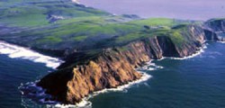
Point ReyesPoint Reyes National Seashore contains unique elements of biological and historical interest in a spectacularly scenic panorama of thunderous ocean breakers, open grasslands, bushy hillsides and forested ridges. Native land mammals number about 37 species and marine mammals augment this total by another dozen species. The biological diversity stems from a favorable location in the middle of California and the natural occurrence of many distinct habitats. Nearly 20% of the State’s flowering plant species are represented on the peninsula and over 45% of the bird species in North America have been sighted.

National Park Service

Canyonlands National Park (Utah)

… was authorized on this date 45 years ago. From the National Park Service:

Canyonlands

Canyonlands National Park preserves a colorful landscape of sedimentary sandstones eroded into countless canyons, mesas and buttes by the Colorado River and its tributaries. The Colorado and Green rivers divide the park into four districts: the Island in the Sky, the Needles, the Maze and the rivers themselves. While the districts share a primitive desert atmosphere, each retains its own character and offers different opportunities for exploration and learning.

Sleeping Bear

Long ago, along the Wisconsin shoreline, a mother bear and her two cubs were driven into Lake Michigan by a raging forest fire. The bears swam for many hours, but eventually the cubs tired and lagged behind. Mother bear reached the shore and climbed to the top of a high bluff to watch and wait for her cubs. Too tired to continue, the cubs drowned within sight of the shore. The Great Spirit Manitou created two islands to mark the spot where the cubs disappeared and then created a solitary dune to represent the faithful mother bear.

Sleeping Bear Dunes National Lakeshore

SleepingBear1

Sleeping Bear National Lakeshore is on the Michigan shore of Lake Michigan. In the first photo (click any of the photos for an album of larger versions) you see the mother bear dune and, in the distance, South Manitou Island, one of her cubs.

SleepingBear2

This photo shows the more than 400-foot drop from the bluff to the lake (and no I didn’t make the trek).

SleepingBear3

The third photo reveals more of the top of the dune and the vegetation that fights with the ever shifting sand.

SleepingBear4

Lastly, this area of Michigan is dotted with many large lakes just inland from the Great Lake. Both Lake Michigan and the inland lakes were gouged by glaciers during the last ice age, ending some 11,800 years ago. Similarly, the glaciers amassed the hilly terrain surrounding the lakes.

More quarters to collect

The United States Mint today announced the nation will honor 56 national sites to be honored through the United States Mint America the Beautiful Quarters Program.  In 2010, the first year of the program, the agency will mint commemorative quarter-dollar coins honoring the Hot Springs National Park in Arkansas, Yellowstone National Park in Wyoming, Yosemite National Park in California, Grand Canyon National Park in Arizona and Mount Hood National Forest in Oregon. 

The United States Mint 

Here’s a list of all 56 sites through 2021. 56 is the number of states and territories.

The New Mexico quarter will feature Chaco Culture National Historical Park in 2012.

Cape Hatteras National Seashore (North Carolina)

… was authorized on this date in 1937.

Hatteras.jpgStretched over 70 miles of barrier islands, Cape Hatteras National Seashore is a fascinating combination of natural and cultural resources, and provides a wide variety of recreational opportunities. Once dubbed the “Graveyard of the Atlantic” for its treacherous currents, shoals, and storms, Cape Hatteras has a wealth of history relating to shipwrecks, lighthouses, and the U.S. Lifesaving Service. These dynamic islands provide a variety of habitats and are a valuable wintering area for migrating waterfowl. The park’s fishing and surfing are considered the best on the east coast.

National Park Service

Capulin Volcano National Monument (New Mexico)

… was authorized on this date in 1916. The monument is located in northeastern New Mexico.

Mammoths, giant bison, and short-faced bears were witness to the first tremblings of the earth and firework-like explosions of molten rock thousands of feet into the air. Approximately 60,000 years ago, the rain of cooling cinders and four lava flows formed Capulin Volcano, a nearly perfectly-shaped cinder cone, rising more than 1000 feet above the surrounding landscape. Although long extinct, Capulin Volcano is dramatic evidence of the volcanic processes that shaped northeastern New Mexico. Today the pine forested volcano provide habitat for mule deer, wild turkey, and black bear.

Souce: Capulin Volcano National Monument

Cape Cod National Seashore (Massachusetts)

… was authorized on this date in 1961.

CapeCod.jpg

Cape Cod National Seashore comprises 43,604 acres of shoreline and upland landscape features, including a forty-mile long stretch of pristine sandy beach, dozens of clear, deep, freshwater kettle ponds, and upland scenes that depict evidence of how people have used the land. A variety of historic structures are within the boundary of the Seashore, including lighthouses, a lifesaving station, and numerous Cape Cod style houses. The Seashore offers six swimming beaches, eleven self-guiding nature trails, and a variety of picnic areas and scenic overlooks.

Source: Cape Code National Seashore

Casa Grande Ruins National Monument (Arizona)

… was designated such by President Wilson on this date in 1918.

CasaGrande.jpg

For over a thousand years, prehistoric farmers inhabited much of the present-day state of Arizona. When the first Europeans arrived, all that remained of this ancient culture were the ruins of villages, irrigation canals and various artifacts. Among these ruins is the Casa Grande, or “Big House,” one of the largest and most mysterious prehistoric structures ever built in North America. Casa Grande Ruins, the nation’s first archeological preserve, protects the Casa Grande and other archeological sites within its boundaries.

Casa Grande Ruins National Monument

Those Europeans, by the way, began heading this way 517 years ago today, when Columbus set sail from Palos, Spain.

Update: Why is the word “prehistoric” in that National Park Service description (twice)? What purpose does it serve?

Free!

America’s Best Idea – the national parks – gets even better this summer with three fee-free weekends at more than 100 national parks that usually charge entrance fees*.

*Fee waiver includes: entrance fees, commercial tour fees, and transportation entrance fees. Other fees such as reservation, camping, tours, concession and fees collected by third parties are not included unless stated otherwise.

U.S. National Park Service

The second of the three weekends is this Saturday and Sunday.

One of the great benefits of reaching 62 is the National Parks and Federal Recreational Lands Senior Pass. It’s $10, good for the rest of your life, and admits you and up to three adult passengers in your vehicle free to all federal recreation sites. It also includes a 50% discount on many charges such as campgrounds. Is this a great country, or what?

If you’re under 62, the similar annual pass is $80.

Some example entrance fees (but not this weekend!):

Bryce Canyon National Park $25 per vehicle
Carlsbad Caverns National Park $6 per person over age 15
Grand Canyon National Park $25 per vehicle
Shenandoah National Park $15 per vehicle ($10 in winter)
Yellowstone National Park $25 per vehicle ($20 for snowmobile)

Actually, more than dead fish go with the flow

Indeed, so hallowed is the Colorado that the waiting list for private trips is measured in years, plural. And why not? Great white water, that gigantic rift in the Earth that you float through over a period of two or more weeks, the simple thought of retracing Major John Wesley Powell’s exploration of the uncharted Western territories in the late 1800s.

But the Colorado is not the only quality river experience you can find in the National Park System. Some aren’t as rocking and rolling as the Colorado is, some are more, and some are simply nice rides into solitude. With that understood, here’s the Traveler’s 10 best float trips in the national parks, in no particular order.

National Parks Traveler’s Top 10 Rivers to Ride in the National Park System

Thomas Jefferson Memorial (Washington, D.C.)

A national memorial to Thomas Jefferson was authorized 75 years ago today. It was dedicated in 1943.

Jefferson Memorial

Thomas Jefferson-political philosopher, architect, musician, book collector, scientist, horticulturist, diplomat, inventor, and third President of the United States-looms large in any discussion of what Americans are as a people. Jefferson left to the future not only ideas but also a great body of practical achievements. President John F. Kennedy recognized Jefferson’s accomplishments when he told a gathering of American Nobel Prize winners that they were the greatest assemblage of talent in the White House since Jefferson had dinner there alone. With his strong beliefs in the rights of man and a government derived from the people, in freedom of religion and the separation between church and state, and in education available to all. Thomas Jefferson struck a chord for human liberty 200 years ago that resounds through the decades. But in the end, Jefferson’s own appraisal of his life, and the one that he wrote for use on his own tombstone, suffices: “Author of the Declaration of American Independence, of the Statute of Virginia for religious freedom, and Father of the University of Virginia.”

Thomas Jefferson Memorial (National Park Service)

Jefferson Memorial Wedding Party

Some fortunate wedding parties are able to have photos taken at the Jefferson Memorial among architect John Russell Pope’s beautiful columns and curves. (That’s Emily and Rob, official daughter and son-in-law of NewMexiKen.)

Camping advisory line of the day

“[A]ll food, garbage, and scented items such as toothpaste, deodorant, sunscreen, toiletries, and chapstick, must be stored in bear canisters, hung from park bear wires, or hung at least 12 feet high and 10 feet out from the nearest tree trunk.”

National Parks Traveler describing new restrictions at Olympic National Park.

Camping in some parks is like trying to get on an airplane. Damn bears. Damn terrorists.

Cumberland Gap National Historical Park (Kentucky)

… was authorized on this date in 1940.

Cumberland Gap

Throughout the ages, poets, songwriters, novelists, journal writers, historians and artists have captured the grandeur of the Cumberland Gap. James Smith, in his journal of 1792, penned what is perhaps one of the most poignant descriptions of this national and historically significant landmark: “We started just as the sun began to gild the tops of the high mountains. We ascended Cumberland Mountain, from the top of which the bright luminary of day appeared to our view in all his rising glory; the mists dispersed and the floating clouds hasted away at his appearing. This is the famous Cumberland Gap…” Thanks to the vision of Congress, who in 1940 authorized Cumberland Gap National Historical Park, visitors today can still bask in its beauty and immerse themselves in its rich history.

The story of the first doorway to the west is commemorated at the national park, located where the borders of Tennessee, Kentucky, and Virginia meet. Carved by wind and water, Cumberland Gap forms a major break in the formidable Appalachian Mountain chain. First used by large game animals in their migratory journeys, followed by Native Americans, the Cumberland Gap was the first and best avenue for the settlement of the interior of this nation. From 1775 to 1810, the Gap’s heyday, between 200,000 and 300,000 men, women, and children from all walks of life, crossed the Gap into “Kentuckee.”

Cumberland Gap National Historical Park

NewMexiKen and Dad visited Cumberland Gap on our 2006 trip — it’s an inspiring and beautiful site. The highway through the Gap was removed in 1996 (replaced by a tunnel). One can now walk the Wilderness Road through a forest much as the migrants moving west did from Daniel Boone on, including some of my very own ancestors.

Bryce Canyon National Park (Utah)

… was designated a national monument on this date in 1923. It became a national park in 1928.

Bryce Canyon

Bryce Canyon, famous for its worldly unique geology, consists of a series of horseshoe-shaped amphitheaters carved from the eastern edge of the Paunsaugunt Plateau in southern Utah. The erosional force of frost-wedging and the dissolving power of rainwater have shaped the colorful limestone rock of the Claron Formation into bizarre shapes including slot canyons, windows, fins, and spires called “hoodoos.”

Bryce Canyon National Park

Bryce is named for Mormon pioneer Ebenezer Bryce.